 Sensor technology 2 Sensor technology 2
The picture shows Light Detection and Ranging as a variation of Radio Detection and Ranging. It uses a pulsating laser to measure continuously changing
distances and reflectivity. These light pulses, together with other data, create a precise three-dimensional image of an outer contour.
LIDAR can be used to create high-resolution maps. Basically, such a system includes at least one laser and one scanner. The former sends high-precision beams onto an object. The images reflected from the scanner
onto the scanner allow conclusions to be drawn about the distance based on time and from the intensity about the reflectivity of the object.
Already more widely used in aircrafts to obtain an image of the earth's surface is LIDAR. The electromagnetic waves emitted either correspond to green light (532 nm) or are near infrared (1,064 nm). Vegetation is well
reflected by these. Not all rays bounce off tree crowns, for example. Some penetrate deeper and produce a three-dimensional map of the vegetation. In order to create this, however, GPS data and an exact picture of the
aircraft's current orientation in all three dimensions are required.
Such orientation is also necessary with LIDAR on a self-driving car. LIDAR is present as a prominent symbol on the roof, but is also split into three sensors at the front, together with radar and a stereo camera in the middle
of the windshield behind the interior mirror. Something similar is possible at the back together with a camera there and on each side.
Compared to an ultrasonic sensor, for example, the LIDAR sensor is, in principle, better suited for outdoor use. Ultrasound can either be superimposed by other acoustic sources and there are objects from which acoustic
wave are only insufficiently reflected and therefore not detected. We know of such sensors in the bumpers, where their maximum range of, for example, 4 meters is more than sufficient.
The infrared sensor may have an even shorter range. We know it less as a sensor that evaluates the reflected waves but rather more as a transmitter of certain infrared waves to operate various electronic devices. If their
return is also evaluated, the result is often no length measurement, but only a statement as to whether the targeted object is within or outside a specified distance, which is less suitable for self-driving cars.
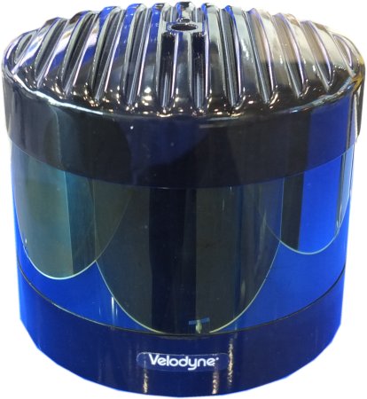
The LIDAR sensor has by far the longest range of the three. It is less influenced by the environment than the infrared sensor. However, it is significantly more expensive than the other two. Like the infrared sensor, it
continuously outputs many more distances via a sufficiently fast data line, as well as numerical values about the strength of the reflection. If you want it to capture the environment as completely as possible, you have to rotate
it and its scanner at, for example, almost 1,000 rpm.
Then it initially becomes a 360∞ 2D sensor. In addition to the voltage supply for the sensor and the motor including its speed control, it has pulse control and data transmission via wire or wireless. If three-dimensional data
is to be obtained, the entire sensor must also be able to be pivoted at a certain angle.
Please note that in addition to the data obtained, the processing computer must also be able to find out and control the respective position within the 360∞ spectrum and the panning angle in order to be able to produce then
a three-dimensional map of the environment with a diameter of 25 meters or more. Since a LIDAR sensor, in addition to its complex control system, usually contains a computer that supplies a complete map to the further
robot controller, you can imagine the relatively high price.
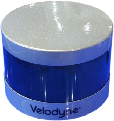
Here is a slightly smaller 360∞ version
|